[Niobrara River Valley as seen from Ft. Niobrara Wilderness overlook. The Fort Falls drainage is just upstream from the cliff, partially obscured behind the ponderosa pine.]


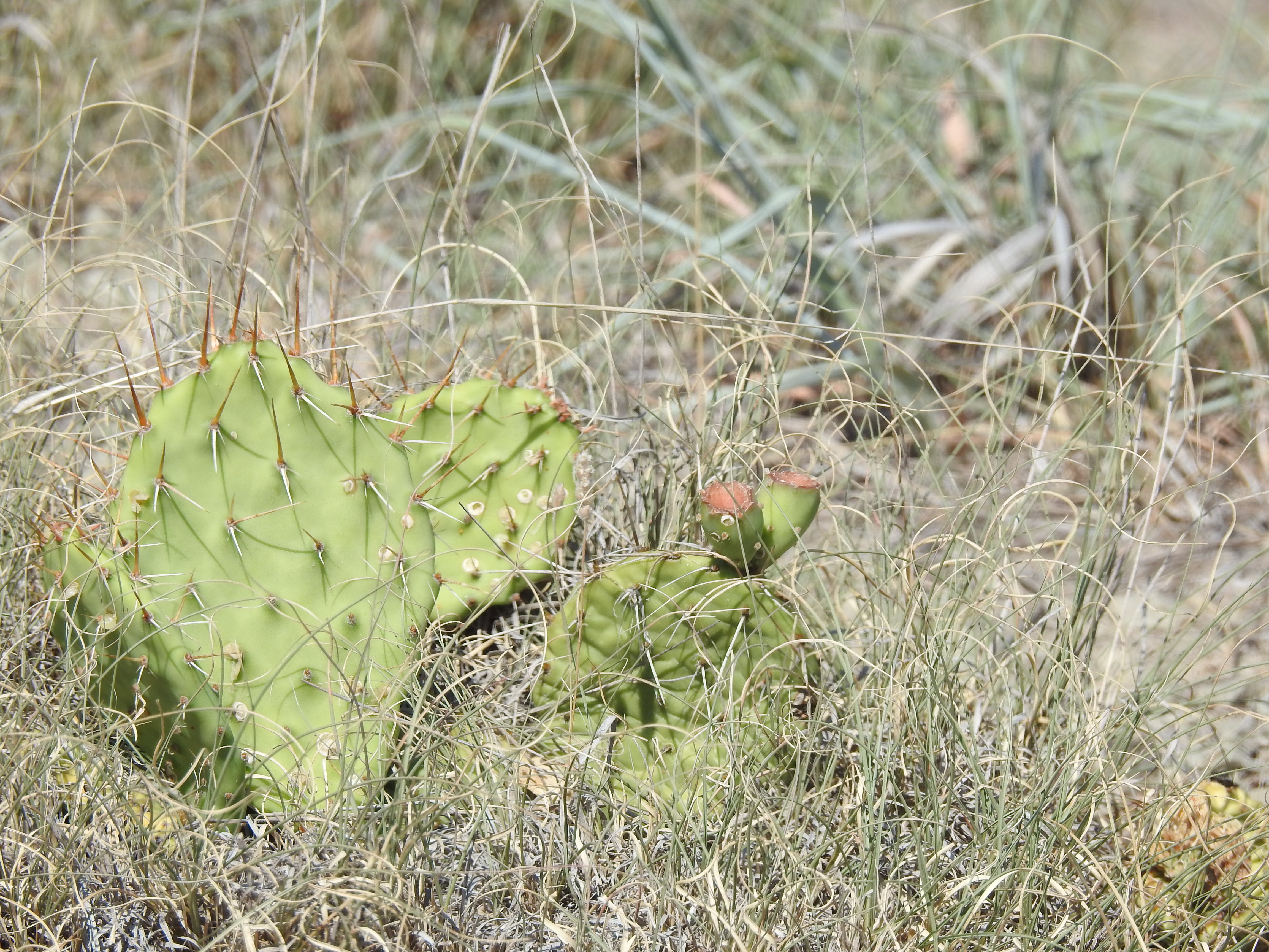
The Niobrara River Valley is a biological crossroads, with three distinct types of prairie (tallgrass, mixed-grass, and Sandhills) converging with three forest types (western coniferous, eastern deciduous, and northern boreal) in a relatively small area. This convergence of habitats makes the valley a hybridisation zone—I myself have seen Baltimore x Bullock's orioles along the river, and organisms from trees to butterflies have also been known to cross species barriers here. It also presents juxtapositions not easily found elsewhere, such as prickly pear and paper birch growing only a few hundred yards apart.
The paper birches, along with bigtooth and quaking aspens, are Ice Age relicts, representing northern boreal forest that was once prevalent here until the glaciers retreated and the climate warmed up, leaving the birches and aspen, plus associated mosses, ferns, etc. confined to cool, shaded, north-facing creek valleys—such as the one encompassing Fort Falls—feeding into the Niobrara. (Sadly, the present global warming phase may put paid to this ecological community along the river. Although the creek valleys are still cooler than the prairie above, many of the birches are dead or dying as average temperatures have risen beyond what they can reasonably tolerate.)


Fort Falls, like all of these creeks, spills out of the Ogallala Aquifer and runs trout-cold for a short distance before joining the warm Niobrara. At the confluence, Jessa and I found fresh raccoon tracks and then went for a short hike along the river, with American redstarts keeping us company on our side and common yellowthroats singing from the reeds and cattails across the way.


Since we were not kayaking this time, we couldn't follow the creek that terminates at Berry Falls, only photograph the falls from across the river at Berry Bridge.


At Smith Falls, we had access from the base of the falls to the confluence. Originally known as Arikaree Falls, this is Nebraska's highest waterfall.


Below the main falls is a secondary waterfall, not especially high but also attractive.


Speaking of hybridisation, Smith Falls State Park is the type locality for "Smith aspen", a natural cross between the bigtooth and quaking aspens. It's believed to be endemic to the park. Next time we'll try to get photos of it and the parent species. For now, we'll close with the Verdigre Bridge.


